National event-based loss and damage database
The demonstrator from the FFG/KIRAS project CESARE combines the harmonized damages and events from the database into a web-GIS portal. It offers the possibility of temporal and/or geographical aggregation, various filtering options, statistical analysis functions, and different visualizations. The data can be selected by date, type of hazard, and affected element. In addition, a preselection of individual events based on frequently searched disasters is available.
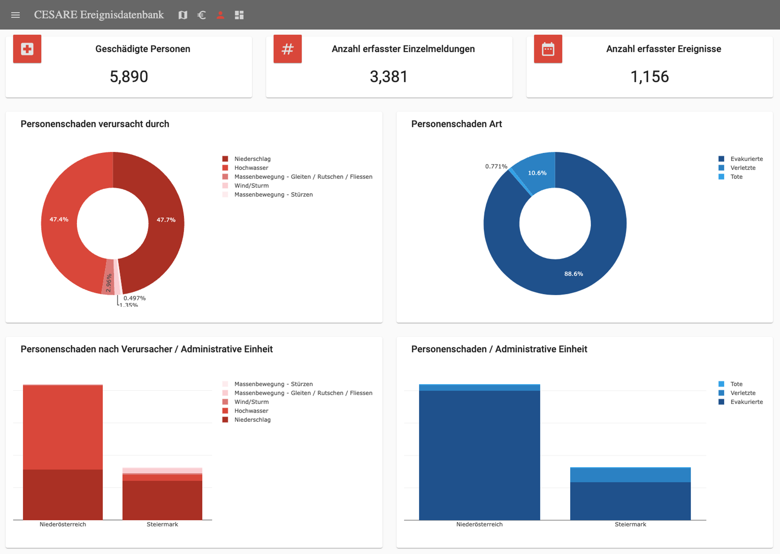
Furthermore, dashboards are available that provide more detailed information on how losses and damage sums are distributed among assets, hazards, and administrative areas. In addition, the losses and damages are compared to the SENDAI indicators for global goals A, B, and C, and the temporal development of the respective damages and losses is shown.
The demonstrator is a closed, password-protected system that can be made accessible to stakeholders. To apply for access, please contact us.
Included datasets
| Dataset | Provider |
|---|---|
| Catastrophic damages to private assets in Lower Austria (KatFonds NÖ Privat) | Lower Austria - Department of Agricultural Development |
| Catastrophic damages to municipal assets (KatFonds NÖ Municipalities) | Lower Austria - Department of Municipalities |
| Catastrophic damages to private assets in Styria (KatFonds Stmk Privat) | Styria - Department of Agriculture and Forestry |
| Catastrophic damages to state assets in Styria (KatFonds Stmk State) | Styria - Department of Civil Protection and National Defense |
| Catastrophic damages to private assets in Carinthia (KatFonds Ktn Privat) | Carinthia - State Directorate, Carinthian Emergency Relief |
| Catastrophic damages to private assets in Salzburg (KatFonds Sbg Privat) | Salzburg - Department for Basic Living Conditions and Energy |
| Deployment data of the Lower Austria State Fire Service | Lower Austria State Fire Brigade Association |
| Torrent and Avalanche Atlas (WLK) | Forestry Technical Service for Torrent and Avalanche Control (WLV) |
| Flood Database (HWFDB) | Federal Water Engineering Administration (BWV) |
| Severe Weather Platform VIolent Observed Local Assessment (VIOLA) | GeoSphere Austria |
| GIS-based data management system for documenting mass movements in Austria (GEORIOS) | GeoSphere Austria |
| Avalanche events | LAWIS |
| Hail damages | Austrian Hail Insurance (HV) |
| Forest damages | BFW |
| Forest fire | BOKU |
| Earthquake events | GeoSphere Austria |
| Wettermelden.at | GeoSphere Austria |
Additional information
| Dataset | Provider |
|---|---|
| SPARTACUS | GeoSphere Austria |
| INCA | GeoSphere Austria |
| SNOWGRID | GeoSphere Austria |
Insights into the demonstrator
Example of the map view: 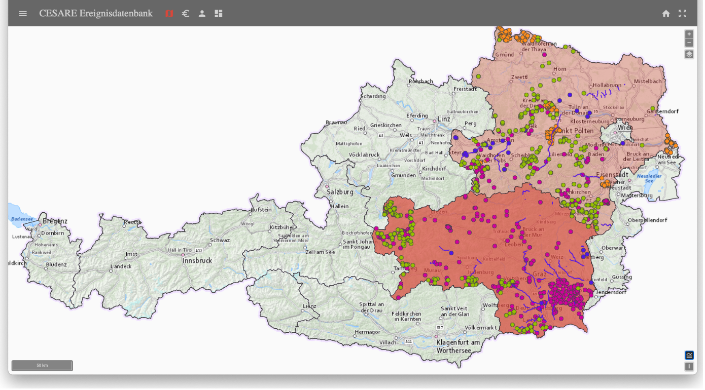
Example of the dashboard view: